You're Welcome Wednesday #2: GPS and Global Navigation Satellite Systems
How Space-Based Technology Benefits Life on Earth
Hello fellow space enthusiasts🚀
Welcome to another edition of “You’re Welcome Wednesday,” a series where I highlight how space-based technology can have wide-reaching benefits for life on Earth.
This week’s topic is GPS and Global Navigation Satellite Systems.
From ancient times to the modern day, humankind has turned to the skies for help answering our most important questions, such as: “Where am I?” and “What time is it?”
In the past:
Sailors often didn’t leave sight of the shore-line when traveling, but those who did used some combination of the night sky (watching the North Star, major constellations, etc) and the sun to navigate the open seas.
The earliest known timekeeping devices, sundials, used shadows caused by the sun to measure time of day.
In the modern day:
Humans use Global Navigation Satellite Systems for determining position, navigation, and time.
WHAT IS A GLOBAL NAVIGATION SATELLITE SYSTEM? HOW DO THEY WORK?
There are four government-owned and operated Global Navigation Satellite Systems (GNSS) in operation: GPS (USA), Galileo (EU), GLONASS (Russia), and BDS (China).
The most widely used GNSS is the United States’ GPS, or the Global Positioning System, which the United States Space Force develops, maintains, and operates. GPS satellites provide free service to both civilian and military users, and it is available to allied armed forces and approved international government agencies.
GPS primarily consists of a constellation of ~30 satellites that broadcasts radio signals from atomic clocks on-board each satellite. These signals are used to:
Triangulate a user’s exact location (latitude, longitude, altitude) anywhere on Earth.
Accuracy can vary based on obstructions, atmospheric conditions, and receiver design features/quality
For example, smartphones may only be accurate up to within a few meters, while a high-end GPS receivers used by the military may boost accuracy up to within a few centimeters or millimeters by utilizing dual-frequency receivers and/or using augmentation systems.
Calculate the current local time to within billionths of a second (i.e. nanoseconds).
This accurate time is used in many applications where performing recording or synchronizing actions is critical, such as ATM and cellular networks, and power grids.
GPS also includes a number of ground stations around the globe that track the GPS satellites, upload updated navigational data, and maintain the health and status of the satellite constellation.

The image below describes how GPS works:
GPS satellites broadcast radio signals providing satellite locations, status, and precise time {t1 } from on-board atomic clocks.
The GPS radio signals travel through space at the speed of light {c}, more than 299,792 km/second.
A GPS device receives the radio signals, noting the exact time of signal arrival {t2}, and uses this to calculate its distance from each satellite in view.
To calculate its distance from a satellite, a GPS device applies this formula to the satellite’s signal: distance = rate x time where rate is {c} and time is how long the signal traveled through space. The signal’s travel time is the difference between the time broadcast by the satellite {t1 } and the time the signal is received {t2 }.
Once a GPS device knows its distance from at least four satellites, it can use geometry to determine its location on Earth in three dimensions (latitude, longitude, and altitude). The signals also allow the receiver to calculate the current local time with high precision, which enables for time synchronization (discussed in the “Use Cases” section below).
Throughout steps 1-4, ground stations across the globe track and communicate with the GPS satellites to maintain the health and status of the satellite constellation.
THE GPS ORIGIN STORY
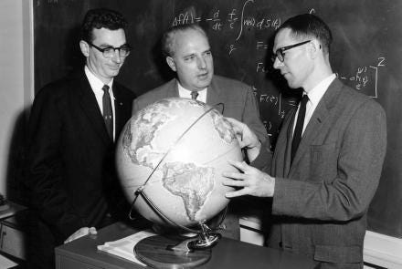
The idea of using satellites for position, navigation, and time (PNT) began in 1957.
After the Russians launched Sputnik 1, physicists William Guier and George Weiffenbach at Johns Hopkins University’s Applied Physics Laboratory (APL) realized they could identify where Sputnik was in orbit by monitoring the satellite’s radio transmissions.
A year later in 1958, the pair discovered that they could also pinpoint their own position on Earth by using the satellite’s radio signal.
This was a big deal—a satellite-based navigation system offered major advantages vs ground-based navigation systems…namely greater accuracy and global scale.

While there are many obvious benefits resulting from accurate and global navigation capabilities, it was the Cold War arms race and Russia’s nuclear threat that justified the billions of dollars of investment required for research, development, deployment, and operation of satellite navigation constellations.
Military officials and politicians believed that satellite navigation constellations would be force multipliers for the effectiveness of the US’ nuclear deterrence posture.
So, in the 1960s the US Navy in partnership with the Johns Hopkins University developed the first satellite navigation constellation called TRANSIT, which could be used to navigate submarines and surface ships.
TRANSIT was a success, but as Cold War tensions continued to grow through the 1960s several other military satellite-based PNT systems were developed to address the increasing need for even greater accuracy and global coverage:
The Navy’s TIMATION constellation tested whether accurate time signals sent from a satellite could provide a worldwide navigation system
The Air Force’s Plan 621B constellation identified the location of aircraft (TRANSIT was too slow to provide aircraft position/navigation)
The Army’s SECOR satellite constellation mapped exact positions of remote places
In 1973, the Department of Defense realized that a superior system could be developed by combining the best technologies from each of TRANSIT, TIMATION, Plan 621B, and SECOR, so DoD planners decided to merge them into a single program—the Defense Navigation Satellite System…which was later renamed to NAVSTAR, and then GPS.
The GPS constellation continued to evolve through the 70s, 80s, and 90s, until it was considered complete after the launch of a 24th satellite in 1995.
GPS was exclusively used by the military until 1983, when the USSR shot down a civilian Korean Air Lines flight that had strayed into prohibited airspace due to navigational errors, killing all 269 people on board.
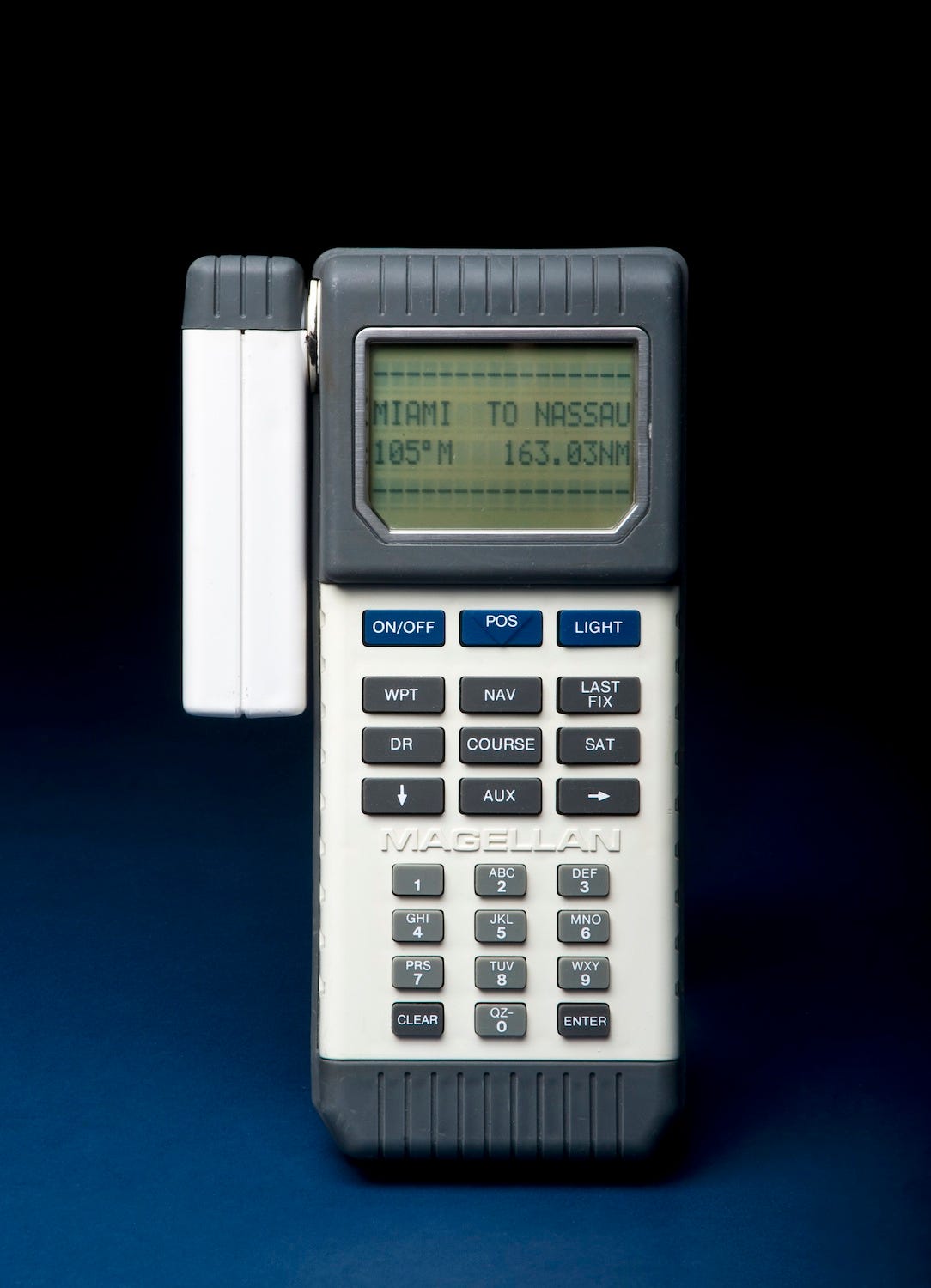
That year President Reagan issued a directive to make GPS a common good available for non-military use, and the first widely distributed handheld GPS receiver came to market in 1988 (pictured below).
While at first GPS signals available for civilians were intentionally degraded, since 2000 civilians to have access to the same GPS signals that the military uses.
Today there are ~30 satellites in the GPS constellation spanning four generations of technology iteration—they are positioned in precise, circular orbits 18,000 kilometers (11,000 miles) above the Earth, completing an orbit once every 12 hours.
GPS USE CASES: EVERYYTHING EVERYWHERE ALL AT ONCE
Global navigation satellite systems such as GPS have been integrated into nearly every facet of life; this quote from GPS.gov gives a great overview:
“Like the Internet, GPS is an essential element of the global information infrastructure. The free, open, and dependable nature of GPS has led to the development of hundreds of applications affecting every aspect of modern life. GPS technology is now in everything from cell phones and wristwatches to bulldozers, shipping containers, and ATM's.
GPS boosts productivity across a wide swath of the economy, to include farming, construction, mining, surveying, package delivery, and logistical supply chain management. Major communications networks, banking systems, financial markets, and power grids depend heavily on GPS for precise time synchronization. Some wireless services cannot operate without it.
GPS saves lives by preventing transportation accidents, aiding search and rescue efforts, and speeding the delivery of emergency services and disaster relief. GPS is vital to the Next Generation Air Transportation System that will enhance flight safety while increasing airspace capacity. GPS also advances scientific aims such as weather forecasting, earthquake monitoring, and environmental protection.”
GPS.gov (link)
Now let’s take a closer look at specific applications of GPS.
Military GPS Use Cases
The US was the first nation to recognize the benefit of utilizing space as a platform for warfare, and it is no surprise that in the modern day GPS has become an integral and indispensable US military asset:
“GPS now is the core navigation system for U.S. military aircraft, vessels, vehicles, and personnel. It has changed the nature of weapons targeting, command and control, guidance of unmanned systems, and supply delivery on the battlefield.”
Smithsonian Institute, Time and Navigation Special Exhibit (link)
Civilian GPS Use Cases (note: sourced from GPS.gov)
Timing Synchronization
Precise time is crucial to a variety of economic activities around the world.
Wireless telephone and data networks use GPS time to keep all of their base stations in perfect synchronization. This allows mobile handsets to share limited radio spectrum more efficiently.
Companies worldwide use GPS to time-stamp business transactions, providing a consistent and accurate way to maintain records and ensure their traceability. For example, major financial institutions use GPS to obtain precise time for setting internal clocks used to create financial transaction timestamps.
Power companies and utilities have fundamental requirements for time and frequency to enable efficient power transmission and distribution.
Roads & Highways
The availability and accuracy of the Global Positioning System (GPS) offers increased efficiencies and safety for vehicles using highways, streets, and mass transit systems.
Many of the problems associated with the routing and dispatch of commercial vehicles is significantly reduced or eliminated with the help of GPS, as GPS enables more effective monitoring to ensure schedule adherence, creating a transit system more responsive to transportation users needs.
It also creates better location information with electronic maps to provide in-vehicle navigation systems for both commercial and private users, and will play a crucial role in autonomous vehicle navigation in the future.
Many new capabilities are made possible with the help of GPS. For example, ride sharing became feasible as GPS receiver technology improved, since people desiring a ride could be instantly matched with a vehicle in a nearby area…just by using their smartphones.
Recreation
The Global Positioning System (GPS) has eliminated many of the hazards associated with common recreational activities by providing a capability to determine a precise location.
GPS receivers have also broadened the scope and enjoyment of outdoor activities by simplifying many of the traditional problems, such as staying on the “correct trail” or returning to the best fishing spot.
Hikers, bicyclists, and outdoor adventurers are increasingly relying on GPS instead of traditional paper maps, compasses, or landmarks.
Surveying & Mapping
The surveying and mapping community was one of the first to take advantage of GPS because it dramatically increased productivity and resulted in more accurate and reliable data. Today, GPS is a vital part of surveying and mapping activities around the world.
GPS supports the accurate mapping and modeling of the physical world — from mountains and rivers to streets and buildings to utility lines and other resources.
GPS-based data collection is much faster than conventional surveying and mapping techniques, reducing the amount of equipment and labor required.
Public Safety & Disaster Relief
A critical component of any successful rescue operation is time. Knowing the precise location of landmarks, streets, buildings, emergency service resources, and disaster relief sites reduces that time -- and saves lives.
Search and rescue teams used GPS, geographic information system (GIS), and remote sensing technology to create maps of the disaster areas for rescue and aid operations, as well as to assess damage.
To contain and manage forest fires, aircraft combine GPS with infrared scanners to identify fire boundaries and "hot spots."
In earthquake prone areas such as the Pacific Rim, GPS is playing an increasingly prominent role in helping scientists to anticipate earthquakes.
As the international industry positioning standard for use by emergency and other specialty vehicle fleets, GPS has given managers a quantum leap forward in efficient operation of their emergency response teams.
Agriculture
The development and implementation of precision agriculture or site-specific farming has been made possible by combining the Global Positioning System (GPS) and geographic information systems (GIS)
GPS-based applications in precision farming are being used for farm planning, field mapping, soil sampling, tractor guidance, crop scouting, variable rate applications, and yield mapping.
GPS allows farmers to work during low visibility field conditions such as rain, dust, fog, and darkness.
Railways
Rail systems throughout the world use GPS to track the movement of locomotives, rail cars, maintenance vehicles, and wayside equipment in real time.
When combined with other sensors, computers, and communications systems, GPS improves rail safety, security, and operational effectiveness.
The technology helps reduce accidents, delays, and operating costs, while increasing track capacity, customer satisfaction, and cost effectiveness.


